| 326 | TOPO! Mapping Software | 2010-12-29 |

I like maps. I carry one with me everywhere I go. If for some bizarre reason I do not have a map with me, I am constantly complaining about my forgetfulness. Amy makes sure that I have a map with me.
Maps are fun. They make dreaming easier. Gazing at the topo lines I try to imagine what the area really looks like. Or looking at a picture I try to find it's location on the map. Whether planning a trip or trying to decide where to plan a trip, maps give a visual shape to the terrain.
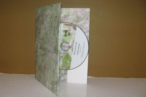
To sate my mapping needs, I use TOPO! Mapping Software from National Geographic. It is available for PCs and Macs. The maps come on a single DVD, a vast improvement over the multiple CDs. The Tennessee and Kentucky DVD allows me to travel seamlessly through the topological maps from Mammoth Cave to the Great Smoky Mountains. I can also pan from Memphis to Ashland, Ky by road or by following along the Mississippi and Ohio Rivers. If I want to plan a major bicycle trip between Louisville and Chattanooga, just draw the route and it will show me every road along the way. Now, if it could only warn me of the barking, bike chasing, dogs!
The maps are easily printed. They include the map margins with important navigation information.
A few TOPO! notes ...
- The maps, until only recently, have not been compatible with any GPS systems. Now, National Geographic announces the maps are compatible with the SatMap receiver. It is sold on the National Geographic site; but I have never heard of it!
- I use the maps from my GPS company on my GPS. I use the TOPO software for trip planning.
- The routes drawn on the maps with the TOPO program can be transferred to most GPS units.
- The maps used are the standard USGS topo maps. The TOPO maps are as up to date as the USGS maps. The maps in TOPO are not the same as the National Geographic's Trails Illustrated Maps. TOPO is mapping software, not ready made maps.
- The TOPO! Mapping Software makes it easy to print customized maps. That is what the program does well. You can download routes from the mapXchange site or load your own routes from your GPS.
- The maps are truly customized. The most obvious feature is that you are able to capture the area you want and nothing more. Gone are the days of having to carry 4 USGS topo maps because the area you are needing is in the corner. With TOPO! you are able to make one map out of the giant, four USGS maps.
- Other features include shadowing - toggled on or off, fly-over - aerial visualizing the route, and elevation profiles - graph of the elevation gains and losses.
- Online info TOPO!
If you are having trouble using the software, send me a note and I will be glad to try and answer your question.
TOPO! Mapping Software is best used for making custom maps. It really makes great looking maps, but you have to supply some of the data. The maps may be saved as a photo (jpg, etc) and printed or viewed on a computer. The routes made can be transferred to most GPS units. The maps are only compatible with the SatMap GPS.
Happy TOPO! trails.