| 825 | Granite Pass Loop | 2013-06-24 |
Through the years we have climbed Longs Peak (Rocky Mountain National Park) many times, but always from the same approach - via the Longs Peak Trailhead. On each climb, when arriving at Granite Pass, we have seen the junction sign, but never followed the arrow. It was too far out of the way.
One of our goals this summer was to hike the Granite Pass - Storm Pass Loop. We wanted to see where the sign at Granite Pass actually lead. When we thought about it, we were amazed that we never were curious enough to just check it out, before our hike.
We were planning on hiking the Loop on Friday, but Thursday morning in camp, we decided to give it a try a day early. We did not hit the trail until 9:00, a very late start, but we were ready to walk.
Starting up the slopes of Longs Peak, we sped along the familiar trail. We walked a bit faster than usual because we wanted to be back down to treeline before any afternoon storms.
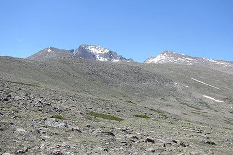
Chasm Lake Junction
At Chasm Junction, we admired the view and then took the path to Granite Pass - the normal Keyhole Route.
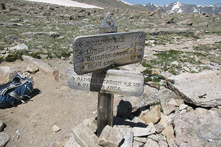
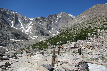
Granite Pass
Traversing the slopes of Mount Lady Washington, it was about a mile to Granite Pass. We took a short break at the Pass before continuing.
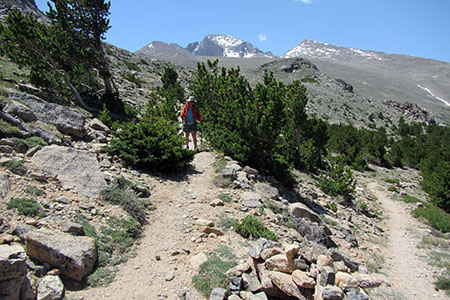
North Longs Peak Trail
Walking into the unknown, we left Granite Pass and started down the North Longs Peak Trail. We loved the trail. It had an easy grade, great scenery, different views of old scenery, and the trail had a soft tread. Instead of the rocky, over-used, Longs Peak Trail, the North Longs Peak Trail was almost cushioned with sand and small gravel and there were no footprints.
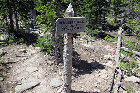
One of the Boulder Brook Camp Sites
We would have liked to have taken the path to the Glacier Gorge Trailhead, but instead we left the trail at Boulder Brook. The upper part of the Boulder Brook Trail was rocky and dry. The trail was steep and not in very good condition. The lower section followed the cascading Boulder Brook and was quite scenic, but it was still very steep.
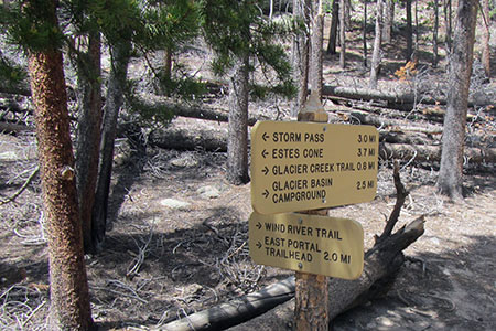
Junction of the Storm Pass Trail and East Portal Trail
The Boulder Brook Trail ended at the Storm Pass Trail (Storm Pass and the Glacier Creek Trails share a brief section of trail). The trail shows heavy horse use, but is rather short. We were followed by one of the stables' rides, but were able to keep ahead of the group.
The Storm Pass Trail, leading to the saddle near Estes Cone, looked a bit like the North Longs Peak Trail, in that it was unused. It was a pleasant hike to the pass. The steep grades were short and we even found a much needed water source.
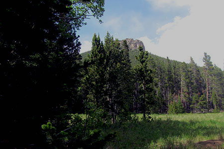
Moore Park looking up at Estes Cone
At Storm Pass we descended the Eugenia Mine Trail toward Moore Park. The trail was in bad shape, like all the other horse trails we hiked.
From Moore Park, it was a short walk to return to Longs Peak Trailhead. The overall loop was about 16.50 miles. We averaged a little over 2 miles per hour with a few very short breaks.
The Loop was a very enjoyable hike. It was a mix of old and new. The trails were not difficult, but it was over 16 miles in length. The North Longs Peak Trail was our favorite section. We hope to climb Longs Peak via the North Longs Peak Trail someday.
Happy North Longs Peak trails