| 898 | Gregory Bald Great Smoky Mountain National Park |
2014-01-13 |
Our friend, David, has been the chief organizer of an annual winter backpacking hike. The trip has become a tradition within the group and last year they even invited me to join them.
As winter of '13 - '14 approached, Amy and I were so busy around the house with our remodeling project that I did not have time to think about the annual backpacking trip. Then, I received a note from Jeff, not David, inviting my friend, Jon, and I to join them on David's Winter Backpacking Trip. Well, sign us up, even though David was not going and an exact destination had yet to be decided. I guess it really didn't matter to me where we were going, as long as it wasn't in Nashville!
Jon suggested doing a hike on Gregory Bald located in the far west side of Great Smoky Mountain National Park. Jeff checked on availability and made reservations. (Thanks.)
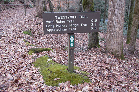
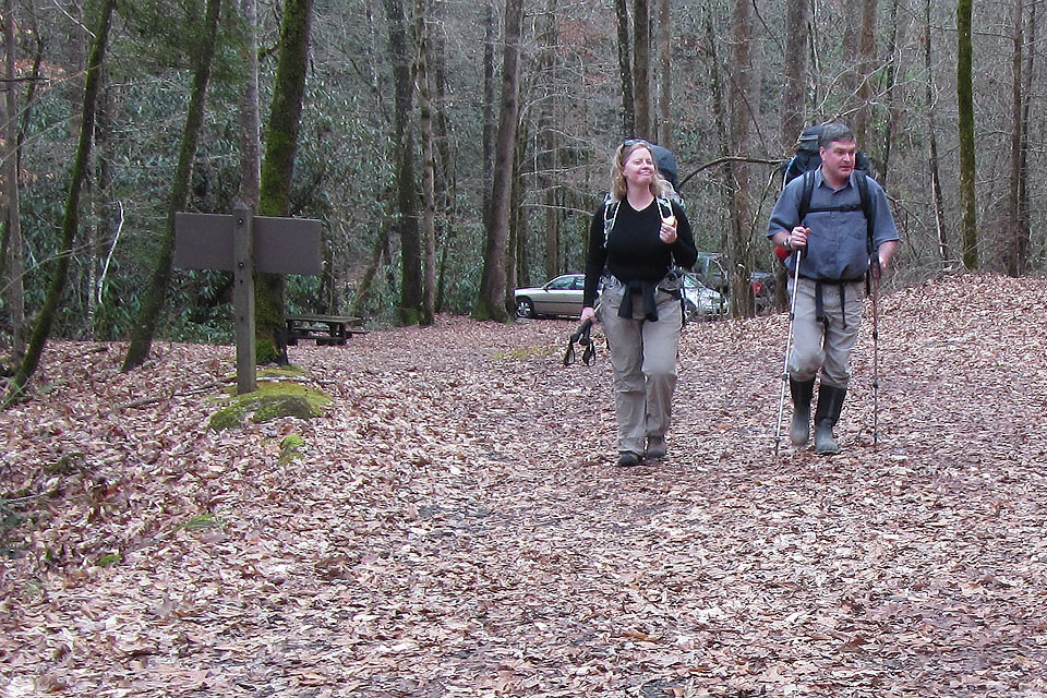
The plan was to begin our hike on Friday from Twentymile Trailhead. Four members of the group were trying to start hiking by 1:00, but the other three of us (including myself) would not be starting until 4:00.
Now for a few pics and trip report ...
(click for larger pic)
From the Twentymile Trailhead (about 1,320'), we followed a gravel/dirt road for a half of a mile to a tee. At the tee we turned to the east and began climbing along another gravel road. The almost smooth tread of the road made for easy hiking, even though the road climbed at a good rate.
At 2.0 miles (from the trailhead) we passed Twenty Mile Creek campsite - number 93 (1,880'). Continuing to climb, we reached Proctor Field Gap, a major trail junction. At the Gap, three trails intersect - Twentymile Trail, Twentymile Loop Trail, and Long Hungry Ridge Trail. The junction is 3.0 miles from the trailhead and 1.0 mile to our reserved campsite on the Long Hungry Ridge Trail.
After crossing a couple of creeks we arrived at Upper Flats campsite - Number 92 (2,520'), in the dark. From far away we had been able to smell the wood burning at the campfire and as we approached it told us exactly where our group was camped.
After greetings, we cooked and told stories by the fire until the rain sent us under the Zing tarp.
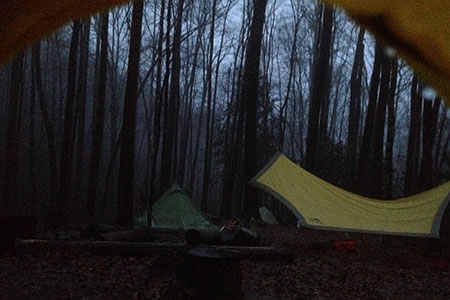
The forecast called for rain Friday night and into Saturday morning. We put a bit of faith in the meteorologist and decided not to leave until noon - which was the forecasted time for the rain to move out of the area. Well, it stormed all night and into the morning. At times the rain was accompanied by strong winds, thunder, and lightning.
Then, sure enough at about 1030, the rain slacked off and by 11 the rain had stopped and we were busy packing to leave by noon.
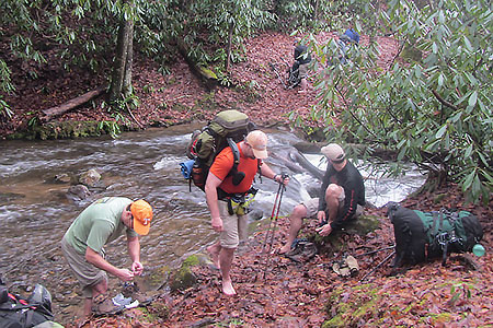
No sooner than we left the camp, we had to cross Greer Branch. There were no bridges or footbridges and the heavy rains had raised the level of the creek. Some of us crossed on logs while others waded. After drying off our toes, we were back on the trail, but then we had to stop and cross Twentymile Creek. There were no dry crossing opportunities so we all waded in the above knee deep water.
A bit further up the hill we had to cross Rye Branch, but we found a log to walk and kept dry.
Glad to be finished with the crossings, we continued the climb. The trail was really an old logging road. It was nice and wide, but was surprisingly steep.
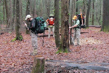
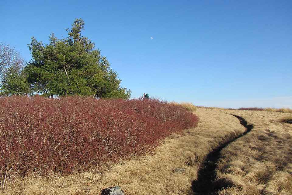
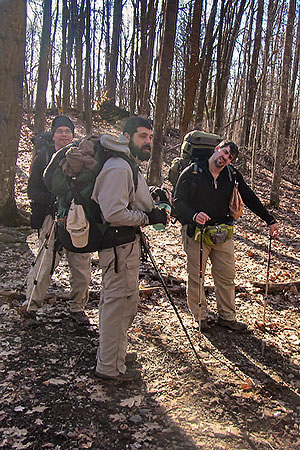
We made a natural split (unplanned) into two groups for the rest of the climb. Brian and Ethan hiked with me as we climbed toward Gregory Bald Ridge. None of us had been on the trail before, so we delighted at guessing where the trail was going. At Rye Patch (4,400') on Long Hungry Ridge, we took a small break and then continued on an easy section of trail to Gregory Bald Ridge.
From Rich Gap at 4,600' on the Gregory Bald Ridge, we had to climb in classic Smoky Mountain style (steep with no switchbacks) over a knob - it was the steepest section of the route. Finally we began the climb to Gregory Bald (4,949').
(click for larger pic)
Gregory was still bald and had excellent views to the north and south.
The freeze-thaw cycle had left a slick muddy trail. As we descended, I fell and muddied my pants. It was all in a day's adventure.
We arrived at the Sheep Pen Gap campsite - number 13 (4,640') at about 4 in the afternoon. Gregory Bald was a good climb.
(click for larger pic)
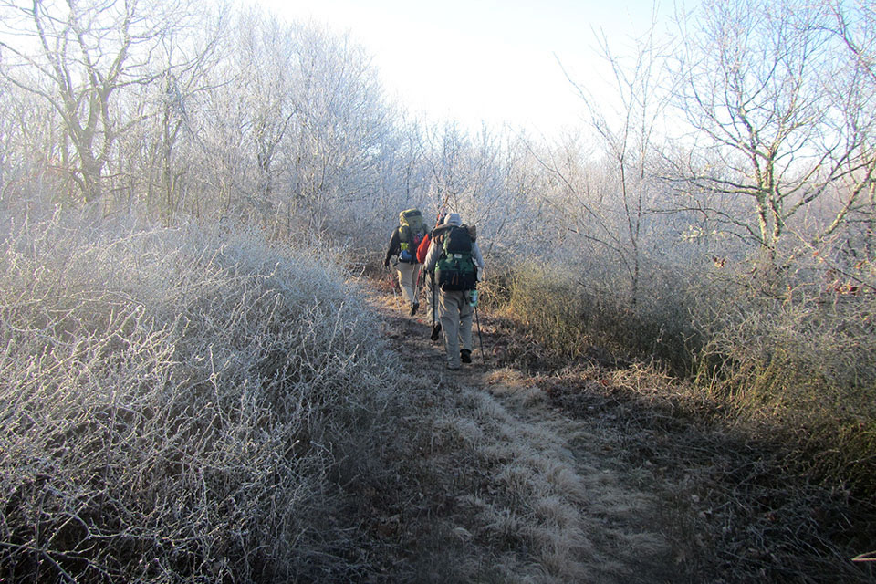
After a cold night camping at the Gap, we woke to a frosty fog on the trees. We quickly packed and headed downhill on the Wolf Ridge Trail. After descending a bit we climbed to Parson Bald about .75 mile from Sheep Pen Gap.
The Wolf Ridge Trail was a great pathway. It crossed several creeks and even passed a spring. The whole crew seemed to enjoy the trail, but it was a bluebird day and all downhill from Parson Bald to the trailhead.
As we descended we heard the roar of Dalton Branch in the hollow below. None of us had been on the trail before, so we did not know if we were going to have to ford the streams or if they had footbridges. Luckily, there were footbridges.
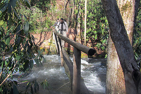
Jon measured one of the footbridges as 50 feet! We were happy we did not have to ford the creeks, it would have been testy.
Soon we were back at the junction with the Twentymile Trail. We had completed the loop and it was an easy .50 mile to return to the trailhead.
It was another good trip. Too bad David was not able to join us, I know he would have enjoyed it too.
Happy trails to the crew and Gregory Bald
We are already working on trip notes and the map and guide to the area. On the next post I will add the trip notes for the route.