| 914 | Gregory Ridge Trail and Gregory Bald Trail |
2014-03-24 |
It didn't take much persuasion to talk my friends Nick and Caley in to joining me. As soon as a date was set, Nick exclaimed - they were in!
We met at Cades Cove Campground on Friday morning. The Smokies were still dark at 7 in the morning (just changed to daylight savings), so we chose 7 as a meeting time. After a brief visit I climbed into the Mini with Nick and Caley and we were off to the trailhead. The Cades Cove Loop Road was already busy as we crept along.
The Gregory Ridge Trailhead is located at the end of Forge Creek Road. It is in the southwest corner of Cades Cove. Minutes after arriving at the trailhead we were on the trail. Caley set a great pace as Nick and I followed. Many things had happened since Nick and I had an opportunity to talk. Caley's pace kept us moving, but allowed us to talk and walk. Nick and Caley had been on a big late summer - early fall ('13) adventure on the Appalachian Trail in New England. They had lots of stories and I had lots of questions as we hiked.
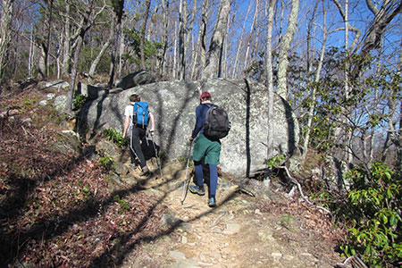
Climbing Gregory Ridge
The Gregory Ridge Trail climbs steadily along Forge Creek. At 2 miles, the trail reaches Forge Creek Campsite (#12). No one was camped at Forge Creek when we arrived, but we had met 4 backpackers descending the trail and overtook 4 backpackers climbing toward Gregory Bald a bit later. We assumed all of the backpackers spent the night at Forge Creek.
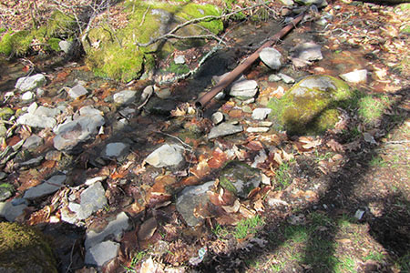
Moore Spring
At the junction of the Gregory Ridge Trail and the Gregory Bald Trail, we took the side trail to Moore Spring (marked as H2O on the sign). The short detour on the overgrown trail led us to the site of Moore Spring Shelter (removed). The spring still had an old water pipe.
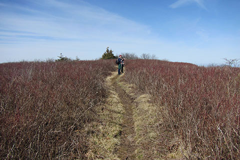
Returning to the Gregory Bald Trail, we climbed to the Bald. After finding a windbreak, we sat and had lunch as the stories continued to flow. There were outstanding views from the Bald. What a great place for lunch.
For the descent, we hiked the Gregory Bald Trail. After a short distance, we reached Sheep Pen Campsite (#13) and the Wolf Ridge Trail Junction. Staying on the Gregory Bald Trail, we followed the wide trail toward Parson Branch Road. The upper section of Gregory Bald Trail was very muddy. It was still in the freeze-thaw cycle. The lower section of the Gregory Bald Trail was much better. We enjoyed the last two miles to the road.
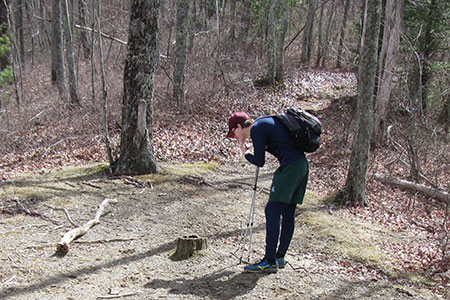
Nick inspecting bear scat on a stump
Reaching a gap on the Parson Branch Road, the Gregory Bald Trail ended. The site is also the location of a large parking area and the start of Hannah Mountain Trail. Parson Branch Road was closed during our hike, this year's seasonal opening is April 11, 2014.
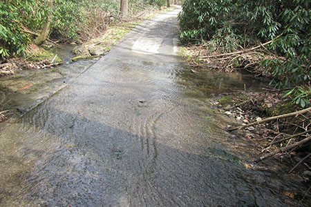
Creek crossing Parson Branch Road
The hike down the road to return to the Gregory Ridge Trailhead was a bit boring. There were a couple of creek crossings that added some fun to the trek.
I had asked Nick for a ride back to Knoxville, so at the end of the hike, they were not through with me yet. We still had a car ride as we finished the Cades Cove Loop, then on to Townsend, Maryville, and finally to Knoxville. I had my camera and GPS bag stashed under my feet in the Mini, so naturally when I left the Mini, I did not see it and left the bag. Kind, Nick mailed the bag to me.
It was truly a great trip. And here's a few notes ...
Gregory Ridge Trailhead is small. There is no official parking, vehicles just parked off the road.
Forge Creek Campsite was a good location with water nearby.
Above Forge Creek Campsite, the trail is steeper, but not too bad.
After leaving Forge Creek, I do not recall any water on the Gregory Ridge Trail.
Gregory Ridge is a hiking only trail. It was in great shape.
The side trail to Moore Spring was overgrown and we hiked it in the winter. It was a good water source. The trail was faint.
Gregory Bald Trail is a multi-use trail. We met two horses and riders. When Parson Branch Road opens, there will probably be even more horses.
Water was available near Sheep Pen Campsite down Gregory Bald Trail about 0.20 mile. The seep flows across the trail.
If the Parson Branch Road was open, it would not have been as much fun to walk.
We enjoyed Gregory Ridge more than the Gregory Bald Trail. Gregory Ridge is a great trail and a great way to climb to Gregory Bald.
A special thanks to Nick and Caley for hiking with me. Their company was special. Their stories were great.
Happy Gregory Ridge Trail
Gregory Bald trip report (from Jan '14)
Gregory Bald trip notes (from Jan '14)
Announcing cloudhiking map of Gregory Bald
Great Smoky Mountain National Park link