| 713 | La Luz Trail Map Sandia Mountains, NM |
2012-10-08 |
On our visit to Albuquerque, NM this summer (12) we hiked the La Luz Trail for the second time.
Our first hike was years ago with our then teenage daughter. We summited the Sandias in a timely fashion and then traversed the Crest (top of the mountain ridge) to the tramway. After a scenic ride down the mountain, we only had to return to our car, less than 2 miles away. It was still early as we continued our hike, but not early enough. The sun had reached the west side of the mountains and it was very hot as we crossed the desert like terrain. Those two miles almost did us in!
On our return visit to Albuquerque, we wanted to hike the La Luz again. Our plan was to leave early, hike the trail to the summit and then return on the same trail. Even, if it was hot, the trail would be all downhill.
On our second attempt, we were better prepared for the heat, but it still was oppressive. No water was available on the trail, but we were able to buy a few bottles of water from the store at the Crest House, a store/restaurant near the summit.
We enjoyed the hike more the second time, but we knew we had spent the day hiking in the sun.
The La Luz is one of our favorite trails. We were excited to do a map for the trail. So for a few La Luz Trail Map notes ...
Amy's brother, Paul, told us "La Luz" translates to - the light.
From the trail on the west side of the mountain, you see the sun rising over the crest as you climb. Then as the day passes, you follow the sun back down the mountain to your vehicle.
Above 9,000 foot on the mountain is a long cliff band. The La Luz Trail sneaks through the cliffs to the top. It is a great route.
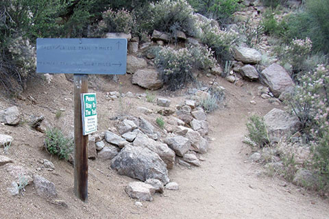
The trail had mileages etched or carved on posts and signs along the trail. The mileages seemed correct.
The trail is maintained by the Albuquerque Road Runners Club. It was in excellent shape.
The running club also sponsors a race on the trail. Their site is an excellent source of information about the area and trail.
As usual, the different sources of trail mileages were not in agreement. On reading the Road Runners site, it seemed that the Forest Service perhaps lowered the traditional mileage. We used the mileages that were marked on the various posts. Those mileages were close to our GPS readings.
We have found that trails measured by a wheel to be the most accurate. We did not have our wheel with us.
If you are trying to find the exact mileage - to the hundredth - the running club or Forest Service might be able to help.
For hiking, our mileages are close enough. For bragging rights, we'd rather the distances be a little longer rather than shorter : - )
The mountain is 10,678 feet tall. The altitude can be a factor on your hike.
There are restrooms (privies) at the trailhead and at the Crest. There was no water.
There were no reliable water sources on the trail. The creeks were seasonal.
The lower section of the mountain (the first five miles) is mostly exposed. Above 9,000 feet, (the last 2+ miles) the trail is mostly shaded.
Too bad, we could not find a good way to show how hot it was by mid-morning on the trail. Start early on summer hikes.
We met hikers just hiking the lower section of the mountain, others that started at the summit and were hiking down the mountain for a short distance and then returning to the summit, and others that were hiking one way and using a car shuttle. There are options that can lessen your exposure to the heat.
If you are from or visiting Albuquerque, the hike is a must do for experienced hikers. Do not however underestimate the sun or the altitude. The hike is more difficult than many of the Colorado Fourteeners (14,000 foot peaks).
Happy La Luz Map trails
Cibola National Forest - Sandia Ranger District