| 968 | Paintbrush Divide Map Grand Teton National Park |
2014-12-30 |
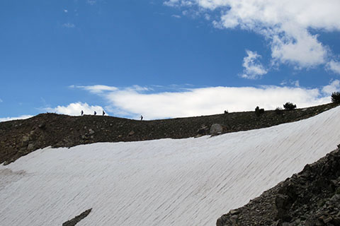
Hikers crossing toward Paintbrush Divide
On cloudhiking.com we have recently completed and posted a map to the Paintbrush Divide area of Grand Teton National Park. The Paintbrush Divide Map encompasses the two major canyons - Paintbrush Canyon and Cascade Canyon, and it also covers three major lakes - Jenny Lake, String Lake, and Leigh Lake and their trails.
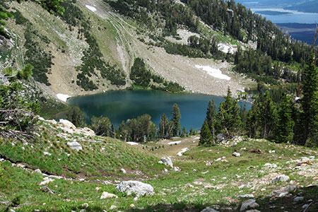
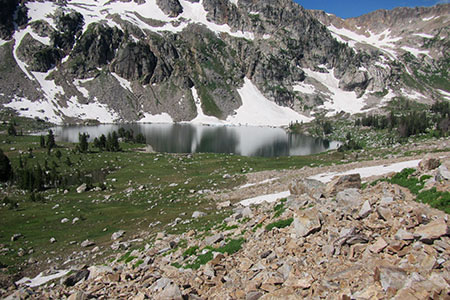
Holly Lake in Paintbrush Canyon
Paintbrush Divide may be hiked as a day hike or as an overnight trip. We enjoy either experience as long as we are fit and acclimated. The minimum mileage for the loop is 19.30. Of course you could also hike into Paintbrush Canyon or the North Fork of Cascade Canyon as destinations and not hike the entire loop.
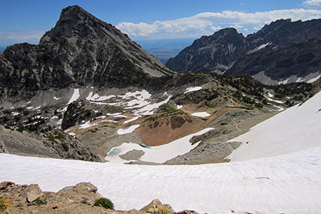
Upper Paintbrush Canyon
It is however, the upper alpine region of the Divide that really makes the hike challenging and special.
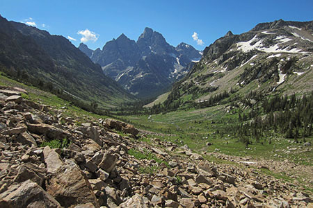
View down the North Fork toward Teewinot, Owen, Grand, and Middle
Once at the Divide the trail crosses over to the North Fork and descends to Lake Solitude.
Lake Solitude
From Solitude it is but a scamper down the canyon to the Forks and then down the Cascade Canyon Trail to Jenny Lake. Follow the trail on the west side of the lake to the north to return to String Lake and finally to the trailhead.
A few more Paintbrush Divide Map notes ...
We have traveled all of the trails (even minor ones) on the map including the paved paths and multi-use (bike) paths.
For the horse paths around the Jenny Lake Lodge and String Lake, we used the Parks GIS data. The horse paths on the west side of Jenny Lake we have walked numerous times and were able to use our own tracks.
The map includes the Jenny Lake Trail, Cascade Canyon Trail, String Lake Loop Trail, Leigh Lake Trail (extending to Bearpaw and Trapper Lakes), Holly Lake Trail, Paintbrush Canyon Trail, Paintbrush Divide Trail, and the North Fork of the Cascade Canyon Trail.
The Paintbrush Divide Map is the same scale as our Teton Loop Map.
The map uses the 0.25 mile spaced red dots on the track line to help hikers determine distance.
We have hiked the Paintbrush Divide Loop in both directions. We prefer (though, it might not be as easy) climbing Paintbrush Canyon and descending Cascade Canyon.
The snow in Paintbrush Canyon lingers a long time. Experience and equipment are necessary to make the climb over the difficult snow sections.
There is a continuous trail from the start of the Holly Lake Trail at the junction on the String Lake Loop Trail to the Forks in Cascade Canyon. The trail changes names several times - Holly Lake Trail, Paintbrush Canyon Trail, Paintbrush Divide Trail, and North Fork of Cascade Canyon Trail. A bypass trail passes through the camping zone near Holly Lake.
The Paintbrush Divide Map is a great addition to our other Teton Maps. Please check out the map, download it, and plan a hike! It is a great adventure.
Happy Paintbrush Divide Map trails
Links
Paintbrush Divide Map, cloudhiking.com, Grand Teton National Park