| 938 | Twin Sisters Slide | 2014-06-25 |
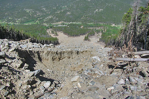
From the crossing, looking down to Hwy 7
In September 2013, Rocky Mountain National Park and Colorado suffered significant damage from a once in a 100 (or 1000, or 10,000, or ...) year flood. Some of the trails in the Park have been closed, while others remain open but all users are advised of dangers caused by the flood.
We - cloudhiking.com - wanted to see just how the trails were effected. (cloudhiking guide and map to Twin Sisters) Yesterday, we left the trailhead at the casual time of 0900. We were not planning on hiking the mountain, we were only going to look at the damage, about 1.25 miles from the trailhead.
When we arrived at the trailhead, we immediately saw things were different. There were only 5 vehicles in the parking area! Leaving the parking area, the access road leading to the trailhead kiosk was heavily rutted. All else was basically normal along the trail, until we reached the slide zone.
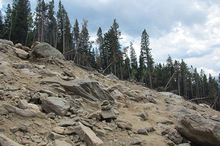
Worn tread across the slide
Trail users had worn a path across the slide area. The soil was fairly solid, but loose rocks were all around.
The slide above the crossing
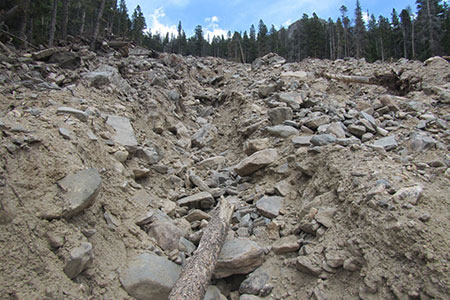
Downed trees lined the sides of the slide area. Once across the slide, the trail continues to a switchback. When the trail returns to the edge of the slide, hikers have cutoff the slide area by going straight up the slope next to the slide to reach the next section of trail. The tread on the cutoff has not been improved and the slope is steep. Three cutoffs are used to avoid the slide. I slipped on the way down the slope and would have fallen hard except for my beloved pack!
Above the slide the trail was back to normal. We continued to the summit and had a great day on an uncrowded peak. We did think there was less dust (and dirt) on the trail. Therefore, there was more rocks on an already rocky trail.
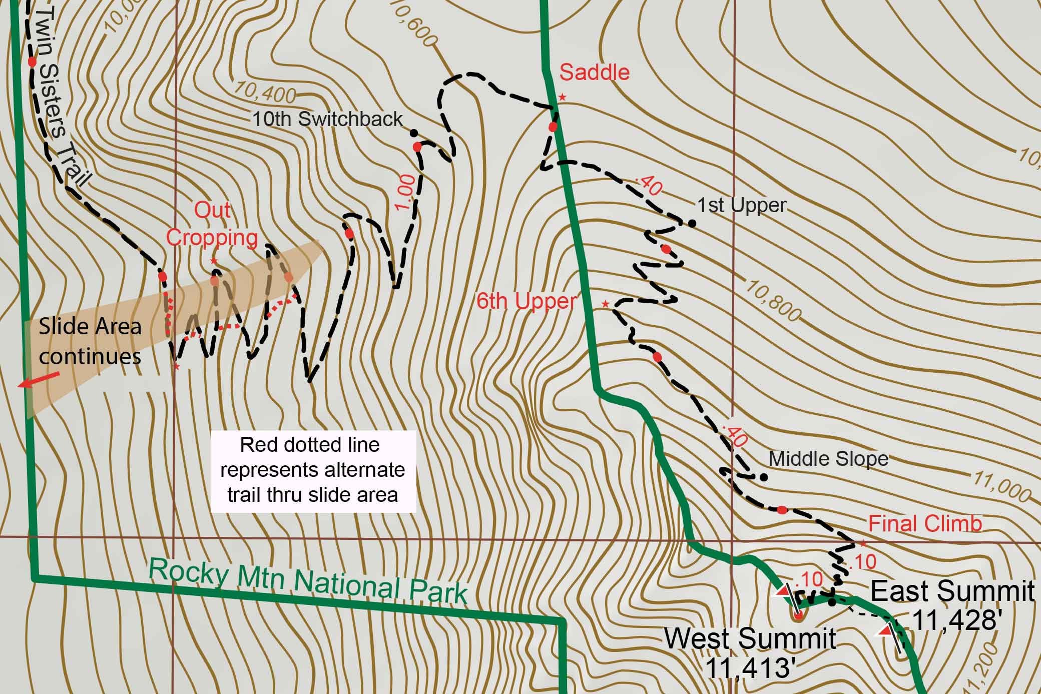
Map of Slide (click for larger map)
Note: the Park has allowed users access to Twin Sisters Peak, but the trail is not at the same standard as other trails. On a dry crossing, the tread is not uniform and there is loose dirt and rock. In rain, the conditions would probably be worse! Your safety is your responsibility. Understand that the trail ends at the slide and then continues on the other side. Be careful, it is okay to turn around.
Happy Twin Sisters Trail is Still Open trails