| 975 | Mount Yale Trail Southwest Slopes Trail Guide |
2015-02-10 |
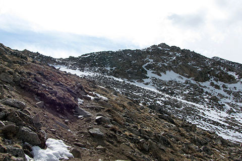
June 2009, the upper slopes of Yale
Mount Yale is located west of Buena Vista, CO in the Collegiate Peak Wilderness. The Collegiate Peaks Wilderness is in the Sawatch Range. At 14,196 feet, Yale is ranked as the 21st highest peak in Colorado. It stands a foot shorter than it's neighbor Mount Princeton.
A couple of weeks ago, we finished the map for Mount Yale and promised the Guide would soon follow. We are happy to announce the new Mount Yale Trail Guide. Working on the Mount Yale Trail Guide, made us want to return as soon as possible to visit Buena Vista and the Collegiate Peaks!
A few Mount Yale Trail notes ...
The Southwest Slopes Route is the standard route on Mount Yale.
As a part of the Wilderness, Mount Yale is protected. So, what is it protected from? Well, it is protected from us, the users. The special rules governing the Wilderness areas prohibits the use of motorized vehicles, limits group size, keeps dogs on leashes, and says no to shortcutting. Of course no rule is of any good unless it is enforced, and to be honest the Forest Service does not have the man power to police every trail. The rules must be self enforced. Don't bend the rules, for they are the rules that govern use, and help maintain the area as a wilderness for generations to come.
The Route climbs over 4,000 feet in 4.6 miles. The rate of rise is almost 1,000 feet per mile.
The Route is popular. The trailhead is accessible by a paved road.
Many of the hikers seem to be very inexperienced judging from their walking skills (yes, walking is a skill), clothing, and emergency preparedness.
Not to be judgmental, but when a slow group of hikers is at 13,000 feet without a pack in the group, and with threatening weather approaching - well they are probably not prepared for the mountain.
Denny Creek Trail is also called Brown's Pass Trail. The trail was an old mining road.
Look for the protected toad (Boreal Toad) along Denny Creek. We got a terrible photo of one.
After the first set of switchbacks on the Denny Creek Trail (on the old road) the trail is fairly tame until crossing Delaney Creek at 2.20 miles from the trailhead.
Of course the rest of the route is a climb. The trail climbs almost 3,000 feet (11,250' to 14,196') in the remaining 2.40 miles. Ouch!
Thankfully, CFI.org (Colorado Fourteeners Initiative) made Yale a project and tamed the slopes with a sustainable route. Before the improvements, the upper route was a scree-fest. (Scree - small, loose, rocks)
Mount Yale receives snow all 12 months of the year. The route is more difficult in snowy weather. The ridge may be very cold and windy any time of the year.
When the ridge is in good shape, (dry and warm) the route to the summit is a fun scramble. With, rain, ice, or snow, the ridge becomes much more difficult.
The Guide includes 25 photographs of the Route, trail description, trail data, directions to the trailhead, notes on the Route, mileage, map link, and user comments.
Our favorite Sawatch peaks are all inside Wilderness Areas.
Mount Yale and Mount Massive are every similar, Massive is just a longer hike. The height (225 feet) difference in elevation gain is really negligible. Both Yale and Massive are great peaks.
We hope you enjoy the Guide.
Happy Mount Yale trails
links
Mount Yale Trail Guide - cloudhiking
Mount Yale Map - cloudhiking
Announcing the Mount Yale Map - Metro to Mountain