| 593 | Collins Gulf and More | 2012-03-06 |
Sunday, I joined (Ranger) Ray and Heidi at the Stone Door - in South Cumberland State Park's Savage Gulf State Natural Area. Our goal was to hike a 26 mile route that is to be used for a trail marathon benefiting the State Park's Ranger Association. With the race being only a couple of weeks away, Ray, who is involved in the race planning, wanted to walk the course.
Leaving Nashville early Sunday morning, I met Ray and Heidi at Stone Door (near Beersheba Springs) at 0630 and started walking at 0700. To hike the 26 miles by dark, we were going to have to average 2.5 miles per hour for 10 or so hours. It was going to be a challenge.
From the Stone Door parking area we started the hike on an old road that lead through the group camping area and joined the Big Creek Rim Trail in a bit over a mile. All was well and we were moving good in the cool March air. We then followed the Big Creek Rim past a few overlooks and to Stone Door.
After a brief stop, we descended through the door (the trail goes down steeply between two rock walls). At 3.5 miles we were at the Connector Trail. Our speed was fine and everyone was moving well. The Connector Trail crossed Laurel Creek, Big Creek, and the Collins River on bridges. We were on time when we arrived at the Sawmill Campsites.
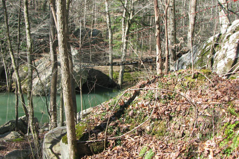
After crossing the Collins River we began the climb up Collins River Gulf (a gulf is a deep chasm or ravine). Not long after starting on the Collins Gulf Trail, another ranger, Jason, joined us. There were a couple of creek crossing that Jason and Ray wanted to check, in case they needed to rig a rope to assist the runners at the crossings.
The Collins Gulf Trail was wet, rocky, and did not seem to be used as often as the other trails. As we climbed our times began to drop. Everyone seemed to be strong enough to keep the speed; but the footing slowed our pace to below 2 miles per hour. As the day was quickly passing, we passed Fall Creek Sink, Horsepound Falls, and climbed to Rocky Mountain Creek, and Suter Falls.
By the time we reached the Collins Rim section of the trail my wet feet were beginning to be a problem for me. My wool socks were basically rubbing all the skin off my feet. It was not blisters, they were just sore. Finally, I stopped and added some Sport Slick to my tender tootsies and all was better. If I had not been trying to maintain a certain speed, I would have stopped sooner. My bad.
When we reached the old Stagecoach Road we descended and returned to the Connector Trail and the end of the Collins Gulf Loop. By that time we all knew we probably were not going to be able to finish the full route. Jason offered to drive us back to the trailhead, but after I said that I wanted to walk back to the trailhead, Ray said he would walk out also. Ray commented that he had to walk at least as far as me, or he would hear about it for the rest of his life. Ha!
It was great to have Jason along on the hike. He added some area history and fun to the trail.
Heidi stayed with us to the end. When we returned to the Stone Door Trail, at about 21 miles, we detoured from the Marathon Route and climbed to the rim, through the Stone Door, and finished on the easy Stone Door Trail. Our overall mileage was about 23 miles and speed was 2.2 miles per hour. Everyone was moving fast enough to finish the original route, but we would have been in the dark. The rocky course up the Big Creek Trail would have been difficult in the dark. We all agreed that it was time to go home while the trails were still happy!
Happy Savage Gulf trails
There is still time to sign up for the Marathon...
Notes: Collins Gulf - 2