
| 018 | Location, Location, Location | 2010-02-04 |
When I was a boy, on our family car trips my father often times designated me, the navigator. I had to follow our position on the road and was often asked questions about exits or towns. I believe that experience helped me develop an awareness of my geographical location.
In my metro, road, and mountain travels I know my location. I might at times not know the best way to go, but I know where I am.
The technology of the twenty-first century has made location awareness easier with "Spot" locators and GPS. With satellite feeds these devices give the user an exact location. I can’t really say that the devices are cheating, I use them regularly myself, but they do compromise learning basic navigation skills.
There are a few simple tricks:
Beg, borrow, download, or buy maps to the area you will be traveling that are in a useable scale. A hiking map and a road map are not of the same scale, they don’t need to be. On the road map you are concerned about hundreds of miles and on the trail map you are concerned about hundreds of feet. Practice using the map. Calculate distances, learn the legend, and orient the map (not necessarily with a compass) so that what you are seeing matches what is on the map.
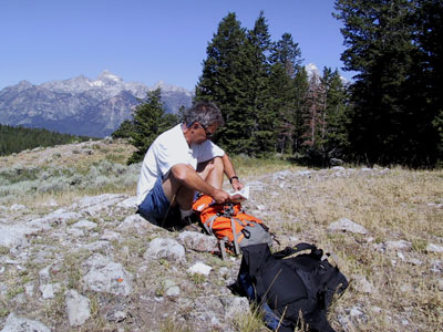
Carry a pad and pencil (lightweight) to help keep track of your location. Keep the pen and paper close by so that it is easy to take notes without taking your pack off.
Wear a watch. Note the time you started and mark each known location with a time. So many times I have thought, "I should be there by now," only to look at my watch and see that I had only been walking for an hour of a five mile hike - clearly not enough time to make that distance.
Use a GPS. Yes I know I said it makes you lazy, but it still helps. My experiences have gone through phases. Initially I was excited about using a GPS - finding an accurate location all of the time. Then I found that it did not give me an accurate location as noted by doing an out and back hike in which I walked on the same path coming and going. The GPS plotted me sometimes fifty feet to one side or the other of the trail. Now, I have gone back to using the GPS and use it as just one of the tools. The GPS is still more accurate than my compass bearings (sorry, we are not going to cover bearings in this blog.)
Use a compass and altimeter. To find your location along a trail an altimeter is sometimes all you need. Check the elevation reading and find the matching contour line where it crosses the trail. In rolling hills it’s a bit more difficult, but you will find it just a bit of attention. Altimeters can be a bit whacky and need to be reset at ever know location. The compass is useful if for no other reason to show you which way north is, and to help you orient your map, but this time to north. Point the compass to north, then match the needle to the compass rose on the map (an arrow). Compass skills are easy, with practice; but I promised not to talk about them in this blog.
Following these simple tricks will help you find your location. Of course you still might be lost, but at least you will know that you are lost.
Happy trails.