| 754 | Standing Stone Park and Trails |
2013-01-07 |
Saturday, we visited Standing Stone State Park hear Hilham, TN. The Park is located about 25 miles north of Cookeville near Dale Hollow Lake.
For years I have wanted to visit the Park, but never found the time. So instead, I looked at the map. Standingstone Lake is formed by three feeders (Bryans Fork, Morgan Creek, and Mill Creek ). The three creeks join at the lake with Mill Creek as the main branch and outlet of the lake. The lake's unique shape reminded me of a crow's foot.
We left Nashville, Saturday morning and drove to the Park. After a brief stop at the Park Office to gain some helpful trail advice from the staff, we started our hike. Leaving our vehicle parked at the Park Office we walked to the Recreational Hall and then followed a trail down a steep hollow to the north shore of Standingstone Lake. We returned to the Office by hiking the spur trail to Cabin 16 and then following the paved road. The loop was about a mile.
Jake, our dog, had a little limp from playing too hard the previous day, so we opted to leave him in the vehicle (vented in cool weather with provisions - of course!) during our longer hike. We were ready for the Lake Trail.
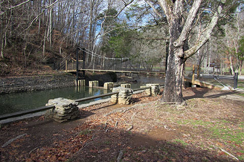
Leaving the Park Office we crossed the main park road and descended through a few switchbacks on a steep trail to the dam. From the road crossing near the top of the dam we turned right and followed the road to the spillway below the dam. A bridge crosses Mill Creek there. After crossing the creek, the trail climbs to the top of the ridge and traverses to another crossing of Standing Stone Road at the Fisk House.
From the Fisk House the trail descends gradually and reaches Beach Road, secondary park road, at 1.40 miles from the dam. Turn left onto the road and cross a stream (Bryans Fork) while following Beach Road. Look sharp for a right turn as the trail leaves the road shortly and begins to climb again. The climb is short and soon the trail contours around and descends to Beach Road again. Turn right and follow the road along the Lake to a road bridge. Cross the bridge over Morgan Creek and turn left to the Overton Lodge about 2.70 miles form the dam. Go past the lodge and look for a bridge crossing a drainage and the re-start of the Lake Trail.
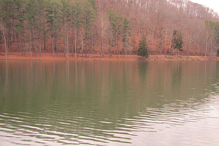
The trail follows close to the shore as it leaves the Morgan Creek drainage of the Lake and enters the Mill Creek drainage. There are great views of the Lake on this section of the trail. A long bridge crosses Mill Creek to the north shore. Continuing to follow near the shore the trail reaches the junction with the trails from the Recreation Hall and Cabin 16.
Continuing around the Lake pass two large boat houses as the trail hugs the shoreline. From the upper Mill Creek bridge it is about 1.05 miles to return to the dam.
We walked up the switchbacks to return to our vehicle parked near the Park Office. Our total hike was about 6 miles (for all of the trails) and then a short distance extra for distractions. The total hiking time was less than three hours.
A few Standing Stone trail notes ...
Our mileages were a little shorter than the published miles, but we have not checked any other sources. Our numbers were just the raw data.
The Park used green markers to blaze the trail. At a couple of junctions we had to search for the next marker to confirm that we were still on the trail. Just be patient and use good trail sense. Find a marker (they are there) before continuing.
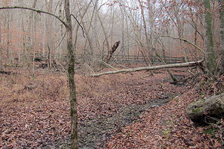
The trail contoured through a few very steep ravines. The trail was solid, but at times was narrow. Take care and use caution.
About half of the Lake Trail really does not follow the lake shore. Instead the trail stays high on ridges with great views in the winter.
The Cooper Mountain Loop Trail begins near Overton Lodge climbs the mountain and returns to the Lake Trail near the upper Mill Creek bridge. We did not hike the eight mile loop.
It would be easier (and a bit shorter) to start and end the trail at the dam instead of at the Park Office.
We saw one other hiker on the trail. We did however, see quite a few folks walking on Beach Road. The road is flat and follows close to the Lake.
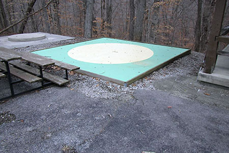
After finishing our hike, we toured the rest of the Park, including the marble shooting yards near the Recreation Hall.
Oh, and yes, Jake got to go swimming in the frigid lake before we left. I guess you would have to be a retriever to understand!
We had a great visit to the Park. It had many recreational facilities plus the Lake Trail and marbles! How much better can it get?!?
Happy Standing Stone Park trails