| 303 | Barfield Crescent Park Trails | 2010-11-05 |
Last Saturday, we had to take our vehicle for maintenance in Murfreesboro, TN. While we were in the area we decided to go to Barfield Crescent Park and hike some of the trails. We had read about the Park and Wilderness Station; but had never been there before.
Googling the Park, I read the directions before leaving the house. I did not copy the info, how hard could it be. Driving south from Interstate 24 on Hwy 231 we turned on Barfield and continued west. We passed a large athletic field complex and Amy commented about the sports fields. I was looking for the Wilderness Station, not ball fields. So I drove past the entrance and on across the river until we stopped at a tee in the road. Amy got out the iphone and found that the Wilderness Station was accessed by Volunteer Rd. We returned to 231 and drove south for a bit further and then took Volunteer Rd to the trailhead. Note: there are two entrances to the Park, one from Barfield and the other from Volunteer. Either entrance will take you to the Wilderness Station.
The Wilderness Station is the headquarters for the backcountry areas of the Park. It is staffed with knowledgeable employees. The Station had water, restrooms, and snack food available. They also sold guide books, bird and bat houses, and a few other related items.
Using the available map we were a bit confused as to how to walk all of the trails. The Park was actually bigger than we expected. We started walking without a plan.
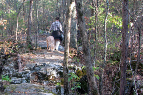
We left the trailhead on a paved path. Our goal was to walk around the Park on the Red Trail (Marshall Knobs); but the paved path was not marked as the Red Trail. The paved path wanders through a cedar glade much like the ones at Long Hunter State Park, including exposed limestone rocks.
The campground had four sites, a toilet facility, and a fire pit. It was mainly set up as a group camping area. The area was inviting.
Leaving the campground we found the Red Trail. We followed the trail along the river to the River Overlook and back to the junction with the Campground paved path. Having connected the two paths, we reversed our path and followed the Red Trail around the Campground to the Gravel Road.
A short hike up the Gravel Road leads back to the Campground. Returning we continued on the Red Trail to the junction of the blue, Valley View Trail. The Blue Trail was a nice walk and seemed to be well traveled. There was an overlook built as an Eagle Scout project.
Returning to the Red Trail, we continued to the white, Rocky Path Trail. The White Trail did not seem as used as the Blue Trail; but there was little difference in the terrain.
Returning to the Red Trail we returned to the Wilderness Station Trailhead. The total distance following the Red, Blue, and White trails is 4.55 miles. We walked 7 miles due to backtracking to connect all of the trails.
A few trail notes...
- No water is available on the trail.
- Restrooms are accessible through the Campground, which is very close to the river section of the red trail.
- There was no litter, except along the river and that probably washed down from upstream.
- There were quite a few people on the trails, but it was a great day.
- My GPS mileages differed from the Park's mileages. They were almost always shorter. I have never had trouble with a GPS reading longer, only shorter. It would be interesting to see the mileage from a measuring wheel.
- There were tenth of a mile markers along the trails. We would not trust their accuracy.
- On the white and blue trails the noise from Hwy 231 is very loud and annoying. That is just the price you have to pay to have a suburban park.
- The paved path from the Wilderness Center to the Campground is an easy grade.
- The paved path leading from the first junction of the Campground Path to Shelters 3 and 4 is a steep hill. It would make a great sled run but is hardly suitable for a wheel chair. The path did not seem to have a name.
The Wilderness Station and trails was a great hiking area. It is an excellent mini-adventure.
Happy Wilderness Station trails.
Link to Barfield trails map on cloudhiking.com.

click and buy, help support our site