| 530 | Trail Sense Where Am I Going? |
2011-12-05 |
Last week we started a short series of articles on Navigation with "Where Am I?" In the navigation article we discussed how to find your position on a trail. Your location is a quick fix.
After we know where we are, we also must know where we are going. Gathering the information acquaints the hiker with the trail and destination before the trip even begins.
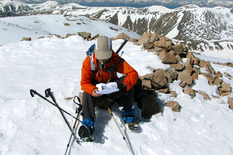
In the spring of 2009, as we were preparing to climb the 14000 foot peaks in Colorado, we spent hours of time compiling information. For each peak we compiled data from web sites, GPS, personal notes, books, guidebooks, and maps. The compilation was a tome of information.
Then, during the summer's climbs, each night before we went to bed, both of us had to read all the information on the next peak(s). Our summer had fixed dates for the starting and ending of our trip. We knew we did not have extra days to have 'do overs'. If we made mistakes on a route, then we would not summit the peak. On each mountain, we only had one chance, we had to know where we were going.
A few notes on Where Am I Going?
Do a search for the trail you plan to hike.
Search for the Park or area. Rules, regulations, and other information about the area will be available.
Key destinations along the trail might be peaks, landforms, bodies of water, or overlooks. They may also be undetermined, such as walking for an hour, as long as I feel good, or until it starts raining.
Many online guides have multiple trail pictures. These are very benefical.
Always consult the kiosk (if available) before leaving the trailhead.
Print or save all information. Bookmark links for future use.
Trip reports (other hikers doing a similar or the same hike) are very valuable.
Search for GPS track logs for the trail you plan to hike. Most GPS units allow you to upload the tracks to your GPS.
If tracks are not available, it might be possible to draw a route on the GPS's accompanying computer program. Some of these programs take a bit of practice; but the benefits make it a worthwhile effort.
We use a third party GPS Mapping program for the Mac, MacGPS Pro. It is an outstanding tool. I am sure there are similar tools for the PC also.
With the GPS it is also very easy to set up waypoints. The waypoints can give longitude, latitude, and elevation.
We try to keep notes from our hikes. The simple words saved after a hike, jog our memory for future planning.
We are always looking for books and guidebooks to areas. The guidebooks are just another view.
We find a lot of out of print books on Amazon.
Maps are indispensable tools for destination planning.
A map wheel will aid in finding distances.
A string with marks or knots can be shaped for a fairly accurate measure.
Some maps are not north up (north at the top of the page). Beware.
The map grid will aid in finding the coordinates to a destination or waypoint.
I do not use the UTM (GPS) grid. I prefer to use the longitude and latitude displayed as the degree followed by the decimal. (-86.50000 is the same as -86.30'00")
Learn to read a map.
After all the information is collected, take notes and make your own guide.
When planning a hike to a destination, take into account the fitness level and acclimation of each hiker. (Acclimating also refers to all changes in climate. Difficulties in acclimation may arise from a change in altitude as well as changes in wind speed, heat, and cold.)
Plan conservatively.
Always be prepared to turn around.
Plan for safety.
Happy Where Am I Going trails
Trail Sense - Navigation - Where Am I?
Trail Sense - Navigation - Where Am I Going?
Trail Sense - Naviagtion - How Do I Get There?